Some history notes on Kenton – interesting…………
And maybe a source of research for the vile Ghost Of Mensforth – get to it peon!
Taken from http://www.newcastle.gov.uk/core.nsf/a/msl_local_histories_k?opendocument&ID=msl101
Kenton

The original shape of the hamlet is uncertain, but it was perhaps T-shaped, with a two-row layout at right-angles to another running southwards to the Town Moor. Other references to medieval Kenton include a late 13th century windmill (HER 1346), a manor house (HER 1348) and a mid 14th century quarry which apparently remained in use until the mid-20th century (HER 1347) – 
Kenton has long been associated with mining. The remains of early mining exist on the adjacent Town Moor and major collieries are recorded there in the early 18th century. Mining continued in Kenton until well into the 20th century - the engine house known as Kenton Tower at the Kenton colliery was demolished in 1928 – and the sites of coal workings, engines and wagon-ways are shown on historic Ordnance Survey maps of the area (HER 3993, 4019,4247 and 4252).
Note from El Patron – I remember seeing in places “lids” that capped old mineshafts, especially on Montague estate….

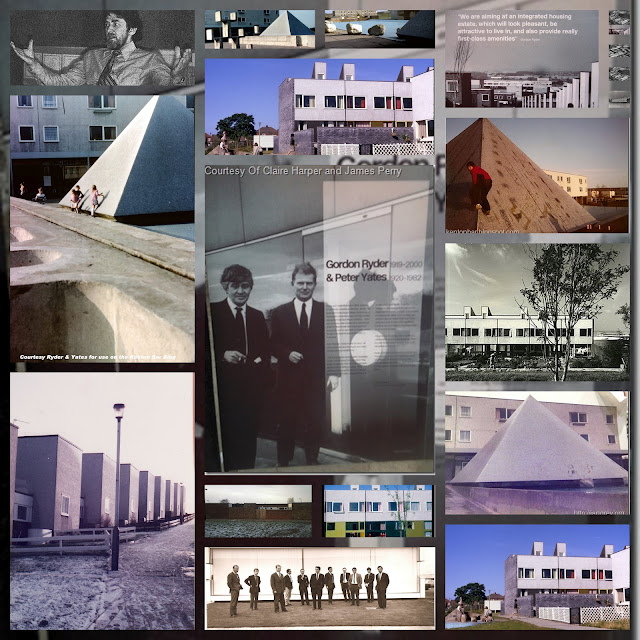
The recent history of Kenton is primarily as a residential centre serving Newcastle. Extensive housing estates, their associated public buildings – notably a Methodist chapel and National School - and an infrastructure of roads and services were built up to the mid-20th century in response to the housing demands of an increasing population during the industrial period. However there are a number of modern sites of cultural heritage importance, including the Kenton Bar Bunker (HER 5035) which was built in 1940 as a World War Two underground operations room and is now one of only five such well-preserved bunkers in the country (its sister-site, the filter room, survives at nearby Blakelaw). Pill boxes were also constructed in the same period (HER 5376-8), but do not survive.

Master, its 'peon' not 'pion'....
ReplyDeleteHow dare you
ReplyDeleteThat Morrisey - I hate that fucking vegetarian bastard. All vegetarians should be forced to eat a bacon and mushroom sandwich - that would cure the pale-faced bastards.
ReplyDeleteWhy do you hate the Grey Hair, Magua?...
ReplyDeleteHelllo nice post
ReplyDelete