Dedicated to Kenton Bar Estate and the Kenton Bar Pyramid. Situated to the north west of Newcastle Upon Tyne. Kenton Bar is a housing estate that is part of Kenton Ward in Newcastle upon Tyne, England. It is situated next to North Kenton, Cragston Park and Cowgate. It was the product of the architectural partnership Gordon Ryder and Peter Yates.
The blog is particularly interested in the architecture of the estate and also to hear anecdotes from Kenton Bar residents past and present
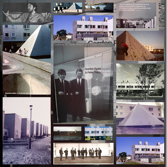
6th photo of 8th wonder of the world
Get link
Facebook
X
Pinterest
Email
Other Apps
By
ghost of mensforth
-
Here it is... utter awe and wonder, yes?... Look at the clarity and detail of the holy grail... HAPPY NEW YEAR!!!!
Talking of things long gone also clearly visible is Hillsview School(where the ruffians and boubders from down the bottom went) and a bit of Dr Raj's surgery sticking out from the back of the shops...
I've just noticed on photo 6 that the T1's(split levels) do not appear to be all the same length ...Gunnerstone, Dunnykirk, Laverock and Hazeley Way are all smaller 2 section T1's... Mallowburn and Byrness are 3 sectioned and Apperley and Hazeldene are all 4 sectioned!...am I right?
To the north west of Mallowburn split levels(next to the shops) clearly visible in the 6th photo are what we called the farmhouse(to the front)and farm out buildings behind...I recall a scottish kid named Dave Coulson and his family rented the house..he went on to become a bell boy aka sting in quadrophenia at the Royal Station Hotel, but I digress...The farm out buildings were used by the council to house materials...the kids soon discovered the outhouses contained pristine planks of wood...I remember one time the posh types from the top, believe it or not broke into the outhouses to steal this wood for bonny night...thankfully the noble bolos (bastions of law and order) were alerted and stopped this ghastly deed... a kid named Ecky took the rap...
Regarding the split levels, I imagine the length of the block is to suit the layout of the Estate and fit all the roads in to get to the other garages.
As to the farmhouse, I can remember a KPBS school trip up to Ponteland Road in order to see Princess Anne pass by. At that time, Ponty Road passed directly in front of the farmhouse. When it was built as dual carriageway, the old road became a bit of an extended layby down there, whilst further up it was southbound and the new road northbound. Then, shortly after that, the pedestrian bridge was built to link Leeches. I can remember the dual carriageway opening as I had moved to leeches by then (I moved in late 70 or early 71) and there is no sign of the bridge on the photo although the bypass to the farmhouse is complete. Another item of note- the small gas building next to the footpath from hazely to Ponty was replaced by a much larger building in the run up to North Sea Gas conversion, but that took place somewhere between 1972 and 1976, I can't date it any more accurately than that.
I'm going to hazard a guess that this photo is 1971.
Avid readers: as i have already told you, I was a cubscout of the 9th Gosforth and as I have already told you I am an expert animal/tracker of signs having gained the 'animal tracking cubscout badge( see post 'snowball blocking of bungalow quadrangle') I note that on the photo (6th of 8th wonder of the world) there are many tracks visible on the kenton school fields... a) Kenton Bar School football pitch in front of the school b)Directly south. Kenton School athletic track(makes me suspect this photo was taken in summer months- I recall this bit of the field was a footballpitch/rugby pitch...) c)Due south again to plateau, evidence of more athletics:discus throwing type trapezium NE of plateau with horizontal lines to mark distance... d) just visible due east then south east of the one visible rugby post a 1cm thin white line of the hop-skip-jump/longjump(no sandpit visible...) NB:that rugby pitch I do not recall...on that 'mini plateau I only remember the girls hockey pitch...) e)Due north from the rugby pitch a football pitch, due north again from that a nothingness in this photo(leading on to the ditch between Kenton Bar and St Cuthberts School...(this became a football pitch later, whilst the other football pitch due south became a cricket pitch...you still with me?!...to the east of the nothingness' St Cuthberts football pitch beyond the hedge line... THE END!
The viewing point(the white rectangle space clearly visible to the right of the T1a's at the top of the estate, Hazeldene Ave in the beautiful photo) alas is no more! :( Somewhere on the blog I am sure(but cannot find it) someone has alluded to the fact that this was designed as a viewing point perhaps for potential professional tenants to get a great view of the estate...it subsequently was used as a place for the driving test centre examiners at the Kenton Bar Test Centre opposite on Kenton Lane to make you turn into and stop the car then to tell you whether you had passed or failed... but it has gone, as I found out today when I went past...boo hoo!....
to the right of the school classrooms( 3rd blockeast) just before the playground and just visible is what I recall as a cylindrical white egg shell covered annex/bit which I have forgotten what it was for...I must find out! I do remember you could like star shape climb up betwixt this and the main classrooms(south facing) as a duff... Anyone know what I am on about?...
hmmm..do you mean it was used to store toys in and was connected to the reception classroom?...In my time that class room adjacent to it was the last year class, taught by most noble Mr Brownlaw, (now called year 6 )...did they not have the infant block to the west/back of the Ryal walk flats then Shades for reception kids?...
The infant block wasn't finished in 1968, although fairly close to completion. The entire car park bit was a building site with cement mixers et-al. That was how I saw in the gas meter cupboard- they did some work in there to couple in the other building.
I have a vague recollection of toy sit-on tractors but they were all put away by the time we ruffians played out.
I can't remember if the cupboard had a door to the outside or not, I tend to mix it up with the (larger) sticky-out one joined to the hall where the five sided tables were kept. (You pushed two together and they made an octogan).
Avid readers: as i have already told you, I was a cubscout of the 9th Gosforth and as I have already told you I am an expert animal/tracker of signs having gained the 'animal tracking cubscout badge( see post 'snowball blocking of bungalow quadrangle') I note that on the photo (6th of 8th wonder of the world) there are many tracks visible on the kenton school fields... a) Kenton Bar School football pitch in front of the school b)Directly south. Kenton School athletic track(makes me suspect this photo was taken in summer months- I recall this bit of the field was a footballpitch/rugby pitch...) c)Due south again to plateau, evidence of more athletics:discus throwing type trapezium NE of plateau with horizontal lines to mark distance... d) just visible due east then south east of the one visible rugby post a 1cm thin white line of the hop-skip-jump/longjump(no sandpit visible...) NB:that rugby pitch I do not recall...on that 'mini plateau I only remember the girls hockey pitch...) e)Due north from the rugby pitch a football pitch, due north again from that a nothingness in this photo(leading on to the ditch between Kenton Bar and St Cuthberts School...(this became a football pitch later, whilst the other football pitch due south became a cricket pitch...you still with me?!...to the east of the nothingness' St Cuthberts football pitch beyond the hedge line... THE END!
talking of CB handles, anyone remember any nicknames of kids from those days? for example I remember 2 twins from up the top known as 'the ghastly twins'and a kid called 'Charlie Fox wears dirty socks' ...there was also a 'Hendas'and a 'Spud' ...any more chaps...?
STOP PRESS!! If you have any pictures of the Kenton Bar Pyramid or Kenton Bar in general then please contact me here. I will gladly add them to the blog with any attribution you care to desire! Contact El Patron HERE Technorati Tags: kenton bar pyramid kenton bar estate newcastle upon tyne pyramid
Here is a photo I found during more extensive research in a library... I remember the football team played for the 'Bagnall Cup' and played 'derbys' v St Cuthbert’s and also v Mountfield, North Fawdon, Wyndham, Montague and Snow Street (we and everyone else always thrashed Snow Street at least 12-0-their home pitch was at an angle of 45 degrees...) Note the' flag pennants' which were inspired by the Leeds United strip from the 1973-74 season on the socks of some of the kids in the front row...these had the numbers of the players on. the 10 first team players are all wearing the blue top with yellow hoop:the' subs' are wearing... whatever! It looks like they must have won the Bagnall cup that year! Anyone recognise themselves or any of the players?... (The tecka is Mr Brownlaw, a true gentleman...) PS:Photo not taken at Kenton bar school-note the basketball net-maybe taken at Kenton school?...) Kenton Bar Pyramid Appreciation Society


how bloody beautiful is this?...
ReplyDeleteNice. You can even see Winthrops in the distance and the old Ministry buildings in the foreground.
ReplyDeleteNot enough detail to spot boulders though.
Splendid photo
ReplyDeleteThe estate looks so fresh and white !
Strikes me just how massive the estate is !
ReplyDeleteYes, the stucco buildings really stand out in the sunlight, as do the garage roofs which must have been particularly shiny.
ReplyDeleteI just noticed that you can see the Dugdale road "Y" Club across the road from the end of Hartburn Walk.
ReplyDeleteI had some happy times in there.
Talking of things long gone also clearly visible is Hillsview School(where the ruffians and boubders from down the bottom went) and a bit of Dr Raj's surgery sticking out from the back of the shops...
ReplyDeleteI am overwhelmed. This is El Patron on holiday.......
ReplyDeletemaster, thank thou for your words of wisdom...
ReplyDeleteI've just noticed on photo 6 that the T1's(split levels) do not appear to be all the same length ...Gunnerstone, Dunnykirk, Laverock and Hazeley Way are all smaller 2 section T1's...
ReplyDeleteMallowburn and Byrness are 3 sectioned and Apperley and Hazeldene are all 4 sectioned!...am I right?
To the north west of Mallowburn split levels(next to the shops) clearly visible in the 6th photo are what we called the farmhouse(to the front)and farm out buildings behind...I recall a scottish kid named Dave Coulson and his family rented the house..he went on to become a bell boy aka sting in quadrophenia at the Royal Station Hotel, but I digress...The farm out buildings were used by the council to house materials...the kids soon discovered the outhouses contained pristine planks of wood...I remember one time the posh types from the top, believe it or not broke into the outhouses to steal this wood for bonny night...thankfully the noble bolos (bastions of law and order) were alerted and stopped this ghastly deed... a kid named Ecky took the rap...
ReplyDeleteI posted a lengthly reply but possibly on a different thread. Rather than repeat myself, I'll watch the comment box to see if it appears.
ReplyDeleteRegarding the split levels, I imagine the length of the block is to suit the layout of the Estate and fit all the roads in to get to the other garages.
ReplyDeleteAs to the farmhouse, I can remember a KPBS school trip up to Ponteland Road in order to see Princess Anne pass by. At that time, Ponty Road passed directly in front of the farmhouse. When it was built as dual carriageway, the old road became a bit of an extended layby down there, whilst further up it was southbound and the new road northbound. Then, shortly after that, the pedestrian bridge was built to link Leeches. I can remember the dual carriageway opening as I had moved to leeches by then (I moved in late 70 or early 71) and there is no sign of the bridge on the photo although the bypass to the farmhouse is complete. Another item of note- the small gas building next to the footpath from hazely to Ponty was replaced by a much larger building in the run up to North Sea Gas conversion, but that took place somewhere between 1972 and 1976, I can't date it any more accurately than that.
I'm going to hazard a guess that this photo is 1971.
Avid readers:
ReplyDeleteas i have already told you, I was a cubscout of the 9th Gosforth and as I have already told you I am an expert animal/tracker of signs having gained the 'animal tracking cubscout badge( see post 'snowball blocking of bungalow quadrangle')
I note that on the photo
(6th of 8th wonder of the world) there are many tracks visible on the kenton school fields...
a) Kenton Bar School football pitch in front of the school
b)Directly south. Kenton School athletic track(makes me suspect this photo was taken in summer months- I recall this bit of the field was a footballpitch/rugby pitch...)
c)Due south again to plateau, evidence of more athletics:discus throwing type trapezium NE of plateau with horizontal lines to mark distance...
d) just visible due east then south east of the one visible rugby post a 1cm thin white line of the hop-skip-jump/longjump(no sandpit visible...)
NB:that rugby pitch I do not recall...on that 'mini plateau I only remember the girls hockey pitch...)
e)Due north from the rugby pitch a football pitch, due north again from that a nothingness in this photo(leading on to the ditch between Kenton Bar and St Cuthberts School...(this became a football pitch later, whilst the other football pitch due south became a cricket pitch...you still with me?!...to the east of the nothingness' St Cuthberts football pitch beyond the hedge line... THE END!
I can recall a long jump pit, I think it was near the hedge just out of shot.
ReplyDeleteI also remember the PE staff used to put up nets for cricket on the school side of the hedge.
Talking of hedges, you can just about make out the Kenton Bar Primary ha-Ha.
Or can we see three long jump pits to the left of the goalpost?
ReplyDeleteThe viewing point(the white rectangle space clearly visible to the right of the T1a's at the top of the estate, Hazeldene Ave in the beautiful photo) alas is no more! :(
ReplyDeleteSomewhere on the blog I am sure(but cannot find it) someone has alluded to the fact that this was designed as a viewing point perhaps for potential professional tenants to get a great view of the estate...it subsequently was used as a place for the driving test centre examiners at the Kenton Bar Test Centre opposite on Kenton Lane to make you turn into and stop the car then to tell you whether you had passed or failed... but it has gone, as I found out today when I went past...boo hoo!....
ps: it is now just part of the grass area that used to surround it(it is still a slightly lighter green colour...)
ReplyDeleteThe blurb in the R&Y book says it had a viewing platform and refreshments. Cak, of course...
ReplyDeleteThe viewing platform you mention is obviously the viewing point I am wittering on about...as to the refreshments...maybe an ice-cream van?...
ReplyDeleteto the right of the school classrooms( 3rd blockeast) just before the playground and just visible is what I recall as a cylindrical white egg shell covered annex/bit which I have forgotten what it was for...I must find out!
ReplyDeleteI do remember you could like star shape climb up betwixt this and the main classrooms(south facing) as a duff...
Anyone know what I am on about?...
Yes, I remember that. It was the reception classroom in my time and it had toys in it.
ReplyDeletehmmm..do you mean it was used to store toys in and was connected to the reception classroom?...In my time that class room adjacent to it was the last year class, taught by most noble Mr Brownlaw, (now called year 6 )...did they not have the infant block to the west/back of the Ryal walk flats then Shades for reception kids?...
ReplyDeleteThe infant block wasn't finished in 1968, although fairly close to completion. The entire car park bit was a building site with cement mixers et-al. That was how I saw in the gas meter cupboard- they did some work in there to couple in the other building.
ReplyDeleteI have a vague recollection of toy sit-on tractors but they were all put away by the time we ruffians played out.
I can't remember if the cupboard had a door to the outside or not, I tend to mix it up with the (larger) sticky-out one joined to the hall where the five sided tables were kept. (You pushed two together and they made an octogan).
Avid readers:
ReplyDeleteas i have already told you, I was a cubscout of the 9th Gosforth and as I have already told you I am an expert animal/tracker of signs having gained the 'animal tracking cubscout badge( see post 'snowball blocking of bungalow quadrangle')
I note that on the photo
(6th of 8th wonder of the world) there are many tracks visible on the kenton school fields...
a) Kenton Bar School football pitch in front of the school
b)Directly south. Kenton School athletic track(makes me suspect this photo was taken in summer months- I recall this bit of the field was a footballpitch/rugby pitch...)
c)Due south again to plateau, evidence of more athletics:discus throwing type trapezium NE of plateau with horizontal lines to mark distance...
d) just visible due east then south east of the one visible rugby post a 1cm thin white line of the hop-skip-jump/longjump(no sandpit visible...)
NB:that rugby pitch I do not recall...on that 'mini plateau I only remember the girls hockey pitch...)
e)Due north from the rugby pitch a football pitch, due north again from that a nothingness in this photo(leading on to the ditch between Kenton Bar and St Cuthberts School...(this became a football pitch later, whilst the other football pitch due south became a cricket pitch...you still with me?!...to the east of the nothingness' St Cuthberts football pitch beyond the hedge line... THE END!